


Las Pedroñeras- el Toboso

dagobert5612
User
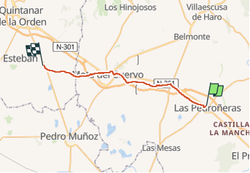

Length
34 km

Max alt
774 m

Uphill gradient
321 m
Km-Effort
38 km

Min alt
679 m

Downhill gradient
336 m
Boucle
No
Creation date :
2023-05-08 04:08:03.449
Updated on :
2023-05-08 15:22:12.31
8h14
Difficulty : Medium

FREE GPS app for hiking
 SityTrail
IGN / Geographical institutes
SityTrail World
The world is yours!
About
Trail Walking of 34 km to be discovered at Castile-La Mancha, Cuenca, Las Pedroñeras. This trail is proposed by dagobert5612.
Description
camino de levante
Positioning
Country:
Spain
Region :
Castile-La Mancha
Department/Province :
Cuenca
Municipality :
Las Pedroñeras
Location:
Unknown
Start:(Dec)
Start:(UTM)
528020 ; 4367100 (30S) N.
Comments
Trails nearby